Motorhometrips
with tips for cycling & hiking
Dolomites
- The motivation for this trip was that we had a had a wedding to attend to, my niece, in Trieste in mid June, so not that we would need an excuse but it seemed a good idea to plan a road trip.
- The outline plan was to travel through France, Germany with a call into the Dolomites for a taster session, before going into Slovenia with a touch of seaside in Croatia before cutting back into Slovenia for the wedding in Gorizia.
- The decision to go through France and not Belgium and Luxembourg was based on the fact that even knowing that the tolls are high, the French motorways are of much better quality than the Belgian roads, which frankly are dreadful. Additionally the route is much more straightforward, with effectively one motorway to Strasbourg and as the traffic is lighter in May then the rationale was that this would be less stressful driving, though heavy on the pocket.
- We stayed at our perennial favourite, the Camping & Caravan Club site at Folkestone, which then allows us to take advantage of the cheapest ferry crossing, the Saver Fare with P&O, knowing that there will unlikely be anything that would prevent us getting that ferry (these are non alterable bookings)
This allows us the afternoon in Folkestone which is rapidly becoming a very attractive seaside location. The whole harbour station area and track, together with the harbour walls have now been developed into a buzzing eating and entertainment area and hopefully it will be successful and will attract a lot of visitors. For a long time Folkestone has given the impression of a deprived run down town but with these recent developments, the removal of the hideous fairground complex and the improvements to the Leas and it’s gardens, hopefully it is regaining its Victorian splendour.
Once we arrived in Calais, the aim was to head down close to Strasbourg and the German border but the beauty of motorhoming is its innate flexibility, as frankly we had had enough driving, so we called into the Camping Municipal at Chalons en Champagne. We had called in here about 10 years ago and basically not a lot has changed. You still get generous pitches, with water on the site, in an attractive setting and yes the sanitary facilities are still in need of some attention. What has changed is that it is a heck of a lot busier which reflects the popularity of touring, its ACSI listing and its convenience as a stopover.
It proximity to the Canal allows a very attractive walk into the town, about a 5 mile return trip. The canal also allows good cycling opportunities.
Lutzelbourg Camping du Plan Incliné
The site is a short drive from Saverne which is about 4 miles off the A4 motorway, giving a total of about 10 miles. It location is,however,a million miles from the blandness of the A4.
The site is right on the Marne Rhine Canal, in a very pleasant setting next to the river Vorn (check) and as it is off the beaten track there were only two tourers on site, though there were permanent small cabins & private sited caravans. The facilities were fine, en par with a CS or CL site.
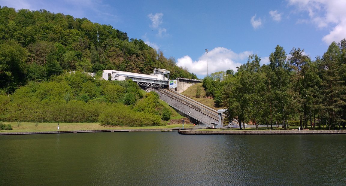
It is also sited very close to the Plan Incliné which I didn’t have a clue about when I arrived but it is basically a fairly impressive boat lift and what is perhaps more surprising is that this considerable investment was made as late as 1969.
WALK La Vallée des Éclusiers 6 to 7 miles.
The boatlift was built to short circuit the original staircase of 17 locks, constructed in 1853 to allow the canal to cross the Vosges mountains and in turn saved about a day in navigation time. What it has also done is to allow a development of a super walk through the old canal route, literally, so at the start the walk it follows a boardwalk suspended above the canal basin.
You can follow the old canal, dry in most places,which gives an even clearer idea of this fantastic engineering feat, as the depth of the canal and some of the locks is frankly mind boggling.
To access this route from the campsite you have to come up to the canal, turn left and at the bridge, go up to the road. This is not a path, it can be muddy, it is reasonably steep and at the end you have to climb over a high crash barrier. Turn right across the bridge and you will pick up the canal path. The alternative to the obstacle course is to take the road, turning right out of the campsite and then turn right towards the bridge. (the main road can be busy)
When you reach the end you can see the Tunnel at Arzviller and to the left the new canal and you are faced with a choice, go back the way you came or follow the new canal.
If you follow the new canal, which brings you to the Plan Incliné, you can not go through the boat lift station. You have to take a path off the canal, signposted I think to Ecluse 13. You descend the canal bank, which is fairly steep and then you are faced with a choice. You can take the path under the canal, which brings you out the other side of the boat lift or you can carry on, crossing the road, with a track to the left, which takes you across the river, under the railway and up to the old canal. The advantage of the latter route is that it is shorter, more picturesque and avoids for the most part roads.


Cycle to Saverne round trip approx 20 miles
This ride follows the Marne Rhine Canal, so the only hills you will face are the climbs up the lock gates, which there are a number of.
The ride had an auspicious start for as I took the bike off the cycle rack, I was confronted with a flat rear tyre, which was surprising, as this had a new inner tube fitted and the tyres are armoured. After removing the tyre, no sign of a puncture but an irreparable split in the inner tube. After reaching Phalsbourg, less than 3 miles later, another flat, and this was due to a split at the valve. Both inner tubes were of the same batch and both must have both been made on a Friday night.
Lutzelbourg is a small attractive town on the canal and as is the same for Saverne, it has a Germanic influence, which is hardly surprising as this area of Alsace Lorraine has exchanged hands a number of times . You do in fact cross the department border of Alsace and Lorraine on the canal.
There is a ruined chateau above the town.
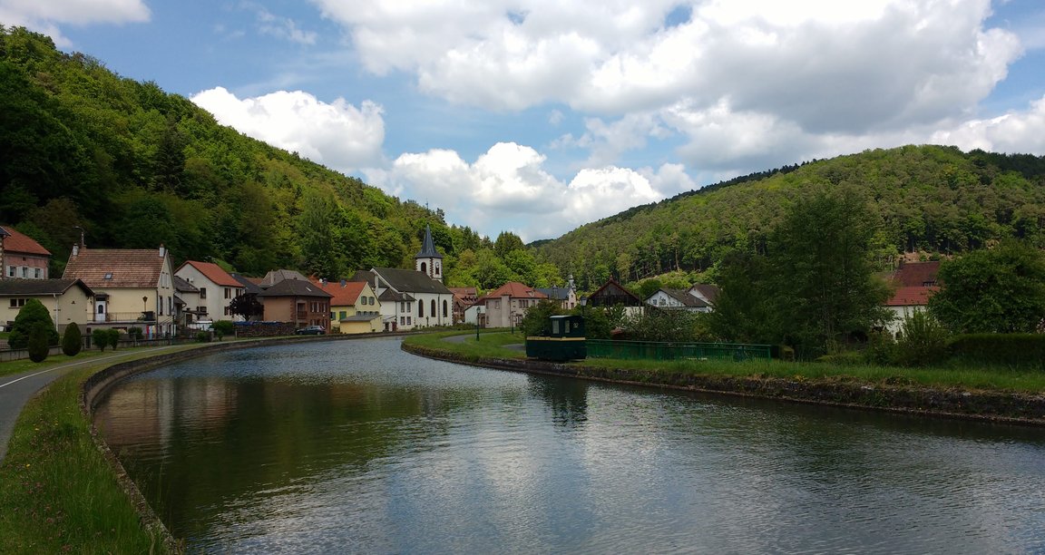
Saverne is a much larger town which the canal goes straight through and is a convenient stop for coffee and cake and there are no shortages of patissiers serving excellent local specialities. (kougelhopf, torche aux marrons & streusel to name a few)
It is also a base for the numerous leisure boats that you see on the canal. There was no sign of any commercial traffic.
The canal is part of euro cycle route 5 and continues to Strasbourg and connects to the Rhine.
In the other direction it goes through Nancy, which arguably had the most beautiful square in the whole of France.
Ironically it then connects up with the Marne Lateral canal at Vitry le François, which in turn goes to Châlons en Champagne where we had camped the night before. This arguably would have been a much more attractive route, albeit slower, than the autoroute. I can see a future cycle trip coming up.


Kirchberg an Der Iller
The next part of our trip took us through Karlsruhe, Stuttgart and Ulm and though there were no major hold ups, this could hardly be described as an enjoyable journey. Traffic was heavy and with an amazing number of HGV's. What I did find interesting was when there were obstructions on the motorways, notably when three lanes went down to two, the lorries stayed in convoy in the right lane. So the end result you had a very lengthy line of lorries and the rest of the traffic proceeded, albeit it slowly in the left hand lane. The journey only became tolerable when we took the A7 to Ulm and by then we had nearly reached our stopover, Camping Christophorus at Kirchberg, which is a few miles of the A7.
This site is what you would expect of a German site, well manicured pitches, hedges cut and a pristine heated sanitary block with a motorhome service point thrown in, though in fact we had water and drainage on site . There is also a very acceptable restaurant.
It also has direct access to the Iller cycle route, which provided a pleasant break from our four wheel transport. The cycle route will take you to Ulm along the Iller river. The cycle path is gravel and generally in good condition but not suitable for a road bike and in places, because of heavy rain, there was deep mud under some of the bridges.

The town of Altenstadt is about a mile from the cycle ride, so it is easily cyclable and has an excellent Aldi. It also has a petrol station and as in most countries, petrol will be cheaper than on the motorway. You do in fact pass through Altenstadt on the way to the campsite.
Dobbiaco (Trablach) Italian Dolomites
The ride down the A7, crossing the Austrian border, down to Innsbruck and then crossing the Italian border was for the most part of it, an excellent scenic ride, helped by the fact that we had brilliant sunshine.
TIP At the German/Austrian border make sure you buy your vignette to cover motorway tolls, fines are very heavy if you are caught without one. If your van is over 3.5 tonne, then special rules apply; you will have to get a GoBOx which is fundamentally an electronic toll device, which charges on the basis of mileage.
TIP Before entering Italy, make sure you top up with diesel as it is very expensive in Italy and be aware that the closer you get to the border, it appears that the price increases in Austria and as normal it is more expensive on motorways.
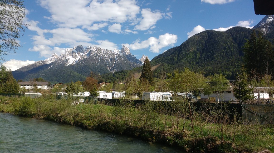
We stayed in Camping Olympia, which in off-peak continental terms was an expensive site, think in terms of Caravan Club prices and equally the facilities are en par with Caravan Club sites. The sanitary facilities were superb.
The site is situated about a mile from the town and for the most parts is a pleasant walk, following the river at the rear of the site.
The main sites we wanted to visit were Toblacher See, Prager See, Lake Misurina and the Drei Zinnen Mountain.
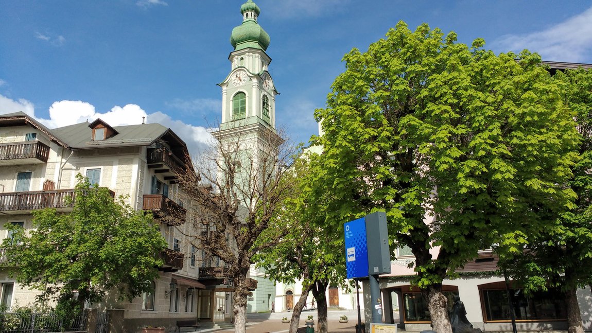
Toblacher See (Lago di Dobbiaco) is an easy walk from the campsite. You take the walk into town, by taking the path at the back of the campsite, which runs past the river and then basically follow the river, virtually into town. It is about an half hour walk. The town has a supermarket commensurate with a town of this size, so do not get too excited but there are the butcher and bakers.
To continue the walk you take the main road down to the new town by the railway station, which in fact is worth a visit. You then pick up the walk, signposted, to the lake, which in total should take you about one and a half hours. The lake is beautiful and when we went it was not very busy, probably on account of the weather and it was teeming with bird life. You can walk all the way around the lake.


We continued the walk at the top of the lake, following route 14, up to the First World War cemetery, which is a reminder that this area was in the front line of the First World War with all the senseless attrition en par with the French trenches but add in sub zero temperatures. More soldiers died from the cold and disease than the actual fighting .
This walk, however,did not commence until fortification with coffee and strudel at the café overlooking the lake. This is reasonably priced given its location and the food is of good standard. There is another bigger restaurant overlooking the lake.
The total walk , including the extension to the cemetery and a walk around the lake was 12 miles. If you want to shorten the walk you can get a bus from the town bus station to the lake and onwards to the cemetery if you wish but this is only a two hour service.


There is a campsite next to the lake but hardly any lakeside views but nevertheless it has a good reputation.
Lago di Braies (Prager See)
You can drive your motorhome up to the lake and for 20€ you can stay overnight in the car park but if you position yourselves at the top of the car park, next to the woods, you can get a fair degree of privacy and of course the lake to yourselves, when the daytrippers go home.
Alternatively you can take the bus which stops right outside of the campsite for 4€ each way . The bus service is hourly off season and half hourly in the peak season.
The lake is stunningly beautiful but it is very popular. It has the ubiquitous hotel at the head of the lake, together with some coffee shops and fast food, alpine style, the sausages spelt divine. We walked around the lake anti clockwise, the first part which is relatively flat. The section on the clockwise section is all steps, as it takes you above the lake, with amazing views.


There are numerous places to picnic and this I think us the most pleasurable way to enjoy the lake.
Nevertheless, no matter how gorgeous the lake is, there comes a time when you want to escape the crowds. We therefore decided to take route 19 up at the top of the lake and though we were not on our own, we only came across a handful of people.
This was a linear route and though you are climbing steadily, it was an easy walk and you continue for as long as you wish.
The path is a good wide path but it had been washed away in a couple of places when we did the walk and these sections were a little trickier to negotiate. In total we did a 9 mile walk, plus going around the lake, the latter of which only takes about an hour.


Misurina Lago de Misurina
Our hopeful plan was to hike to and do the Drei Zinnen circuit but we were too early in the year. I knew the shuttle bus service was not operating until early June but I had hoped we might have been able to walk from the toll gate. Unfortunately the winter snow had been exceptional this year so it was off limits.
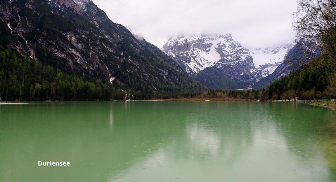
We took the van up to Misurina which is an easy drive. On the way up we called into Duriensee (Lago di Landro). You can walk on both sides of the lake but you can not complete the loop.
Reaching Misurina, given we went on a pretty damp day, parking at the side of the lake was easy. The lake was still frozen, which is perhaps understandable, as you are at 1752 metres and on the far side of the lake there was still plenty of snow but nothing to stop you completing the circular walk.
It was so quiet and very little open that we enjoyed a brunch overlooking the lake.


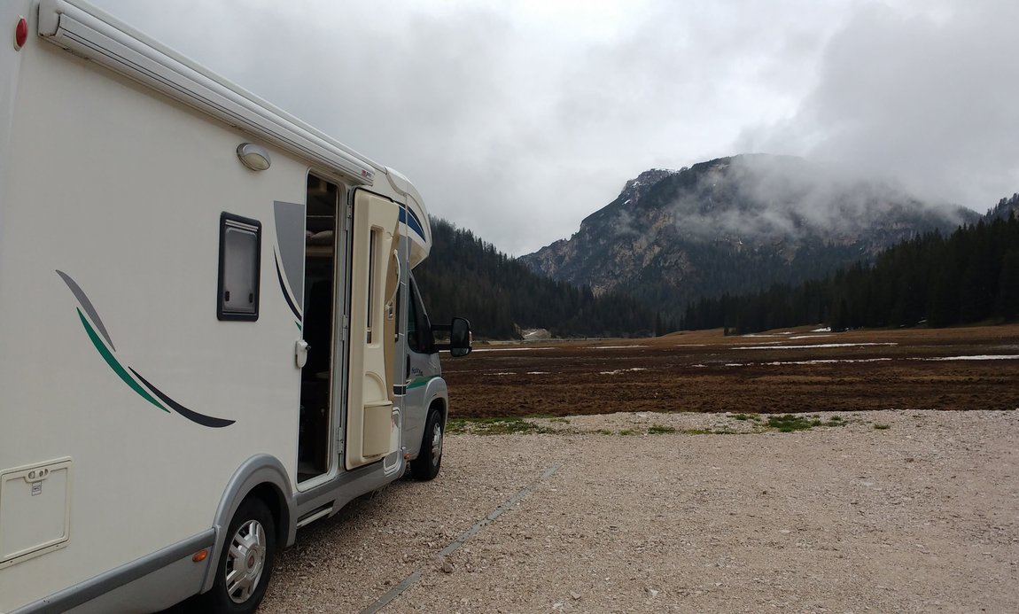
We then went up to the Sosta above the lake which is the Italian equivalent of an Aire. We had planned to stay at Camping Alla Baita opposite but it was closed. Reviews state that the site is somewhat basic but it did not look too impressive but then it was a very miserable day.
It was pretty cold and though the diesel heating copes admirably it is not long before you have to move on because the electric fan will give up and the heating will stop.
Talking to a local, he said that the road was open to Lago d'Antorno so we decided to drive and park up at the still frozen lake and walk up.
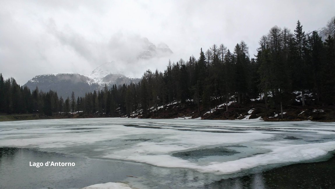
The advantage of the road being closed was that you could walk up the road. On reaching the toll booth there was a reminder how expensive the toll was, 45€ for a motorhome but this does allow overnight parking. Even climbing to the lake involved first gear all the way so I can imagine the same for the longer final climb to Refuge Auronzo and the walk around the Drei Zinnen. It must, however, be stunning to wake up to the Drei Zinnen and watch the sunrise and sunset.
The alternative is to catch the shuttle bus from Dobbacio and this stops at the Sosta
We climbed the toll road to the snow line and the only view that we got of the Drei Zinnen was that on the toll information board but it was good fun.


Lienz It was really now the time to get off the mountains, the weather forecast was showing no sign of improvement. Though it is notoriously difficult to predict weather in the Alps, I think we were on a fairly short bet that things were not going to improve.
Our next port of call was Lake Bled in Slovenia but the forecast was heavy rain, so we made the decision to hunker down in Lienz Austria for a day, a very short hop from Dobbacio, in fact the train runs between the two towns. The rationale was that as it was a town, we could restock and additionally if the weather was bad, we would have more chance to get out and about in a town.
The site we stayed at was Camping Falken which is within an easy stroll of the centre and at 20€ seemed reasonable value but what we hadn’t legislated for was another 6€ in taxes of various sorts, as the guy explained, tongue in cheek, the mayoress needed a new BMW. Facilities wise you could not fault it, superbly finished sanitary facilities, heated which on a cold wet day was most welcome and they also ensured that you would never run out of toilet paper and in France you will struggle to get one sheet.

The town has a pleasant old centre to stroll around and though we would have preferred to be walking in the mountains, beggars can not be choosers and in any case we had a pleasant day walk down the river Drau.
Ironically Lienz is called the sunny town and during our stay you would have to use some considerable imagination to see it surrounded by snow peaked mountains but there were enough glimpses for you to be able to fill in the gaps, a bit like painting by numbers.

