Motorhometrips
with tips for cycling & hiking
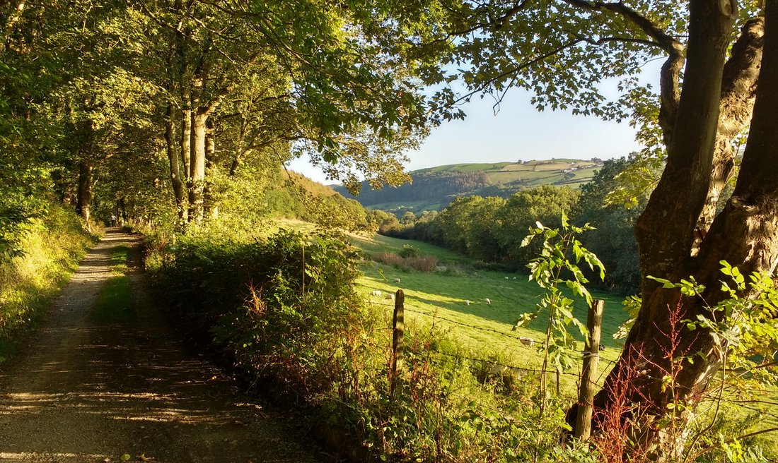
Aberystwyth The Ystwth Trail
Pantmawr Farm Camping & Caravan Club Certificated Site
We were fortunate enough to come across this fabulous CS in an idyllic rural setting on the banks of the River Ystwth and right on the Ystwth Trail, which runs from Aberystwth to Tregarron, for some 29 miles.
The friendly flexible site owners, Tom & Anna run a livery business from their gorgeous property and attached is the level site, offering a mixture of grass and hardstandings with a small toilet and shower facility with washing up facilities attached. This site thoroughly deserves its first class reviews.
Ystwth Trail
The trail in part runs along the old trackbed of the now redundant Manchester & Milford Railway. I say in part, because less than enlightened landowners and farmers, objected to the trail and as a consequence have not released sections of the old trackbed. The result of this is that there are certain sections where the trail can not run on the old trackbed and is diverted onto local roads. So the result is an incomplete trail with safety issues,when it is diverted onto local roads, not making it suitable for family use.This is a frustrating situation and it is highly unlikely to be changed and I would suspect that this leads to an under use of this facility. Nevertheless there is still plenty of track for family use and the route is easily accessible for experienced cyclists. In total the route covers about 21 miles.
Aberystwyth
The campsite provides an ideal base for exploring the town,being about a 30 minute bike ride, covering a distance of about 4.5 miles, primarily off road or following quiet estate roads. This route,however,has had to be diverted from the original track and as a consequence be prepared for some uphill sections, but nothing strenuous. My only gripe is when it has to cross the A487, there is no controlled crossing. Frustratingly this is an oversight of many local authorities, when planning cycle trails. When you reach the town, you can divert off to the harbour, which is more pleasant than following the main road.
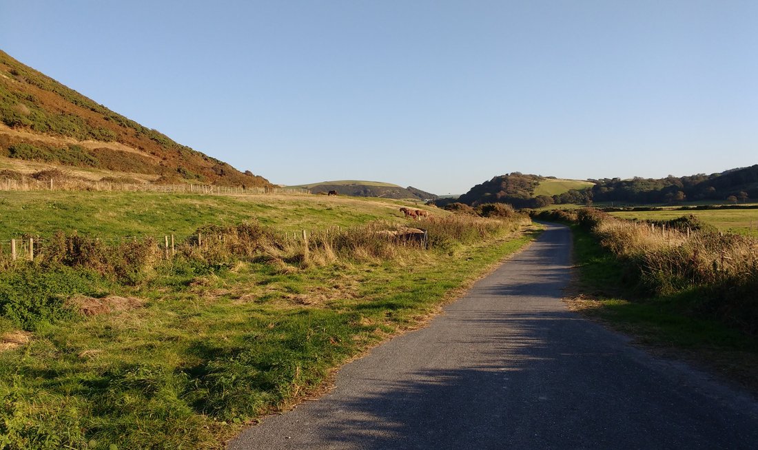
The track is a mixture of gravel in the forest sections to tarmac as you cross the main road towards the sea.
Aberystwyth is a small seaside market town in West Wales, overlooking Cardigan Bay and with a population not much over 15,000 , it is hardly surprising that it is not a hive of activity and even with the influx of some 10,000 students to this university town, you could hardly describe it as a buzzing metropolis.
Nevertheless it is an extremely attractive seaside town, much devoid of the funfair amusement arcade paraphernalia of many contemporary seaside resorts.It is divided into two distinct but connected bay areas,the more southerly one is quieter and linked to the bustling harbour area. The ruined medieval castle, built by the Norman kings to subjugate the Welsh divides the southern beach from the busier northern beach with its increased number of eateries and hotels. Both bay areas are flanked by colourful terraced houses which on a fine day radiate the sunshine. Do not,however, be fooled, this area can be hit by severe weather and in the past has suffered from severe flood damage.
At the end of the north bay there is a cliff railway. Behind the seafront there is a network of relatively narrow streets and in my view full of character. Then further behind is the normal shopping area, containing the High Street chains, that you would get in any town.


No visit to Aberystwth would be complete without a visit to the Vale of Rheidol scenic narrow gauge steam railway, which runs from the town, through stunning scenery, to the tourist attraction of Devils Bridge.The big plus is that the carpark is motorhome friendly and in fact the town is also motorhome sympathetic with designated parking places in the car park next to the harbour and it is even possible to stay overnight here as well but before you get carried away, places are limited.
Cycle Ride to Tregarron Approx 32 mile round trip
Though the cycle ride to Aberystwth is fairly flat, the same can not be said for the ride to Tregarron but having said that the first section from the campsite to Trawsgoed follows the old rail route along the river Ystwyth and is completely level and with constant views of the river is a very enjoyable section and I would guess is one of the more popular sections, being totally family friendly.
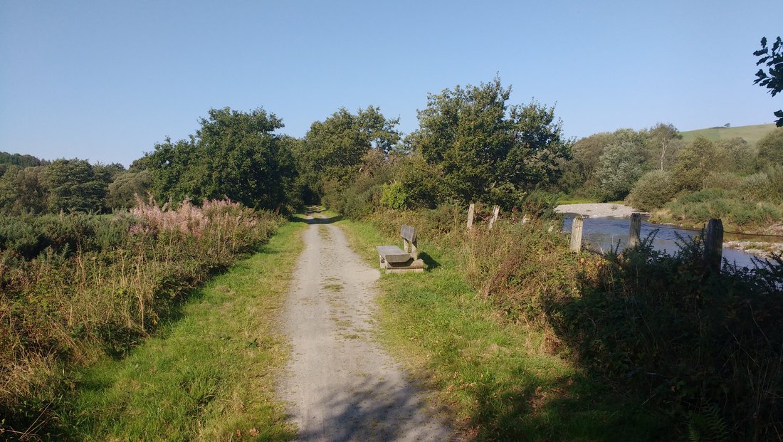
On the route, other than the fact that it is flat, there are few visible vestiges of the old railway,a platform is discernible, as is the remnants of the bridge at Trawsgoed but no stations remain.At this bridge you come across the first detour from the original track, you drop down to the woodland area of Black Covert and follow the minor road for just over a mile, which is clearly signposted. Though this section does involve some climbing, there is nothing too strenuous and there is very little traffic on this road. We came across one vehicle on the way up acting as a chaperone for a group of sponsored walkers and one vehicle on the return journey and two horse riders.
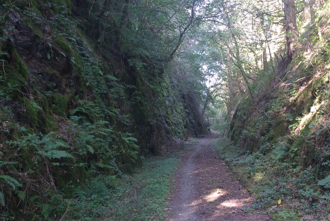
You then return to the railway track to what I think is one of the most stunning sections. The track climbs gently through a cutting, hewn through solid rock, offering superb views of the countryside below.The engineering of the line is impressive as it climbs from the valley floor at some 50 metres above sea level to this cutting at about 200 metres above sea level. You can not help but reflect on what all of the engineers and labourers involved would now think to see their creation now used as a cycle track. Though the track here is well formed, leaf litter and I would guess lack of use means that it is muddy in places and best suited to mountain bikes or hybrids.
After about a mile and a half, frustratingly you are forced off the track again and on this occasion in a somewhat severe way, as you have to take a very steep track down to pick up the B4340. You have to follow this road for about 2 miles and some climbing is involved as you are now reaching the summit of you ride at about 250 metres and thoughthe road is not over busy, care has to be actioned.
You join the old railway track again and the cycling becomes easier as you descend gently down to Cors Caron moorland and then you are on a flat ride of about 4 miles.
Cors Caron is an ancient peat bogland and crossing this again presented the Victorian engineers with considerable challenges but today it is Nature Reserve and well worth a visit in its own right.
You then have to take to the road again for about 2 miles and the final push to Tregaron.
A short ride outside of the town takes you to the Riverbank Cafe & Farmshop which is a good stop for lunch before the return journey which has more downhill sections than uphill.
This was an interesting cycle ride, across some stunning scenery, with considerable variety from valley floor to more challenging uphill sections offering stunning countryside views with a peatbog marsh area thrown in. You are,however,left feeling a little short changed due to the missing sections of the railway, which would have allowed a more continuous ride and avoided the busier road sections. This lack of continuity is an opportunity missed and as a consequence the whole route could not be classified as family friendly and you are left with the feeling that you have an underused facility. This was undoubtedly the aim of the landowners who acquired the old railway line fairly cheaply and as a consequence of their intransigences have achieved the aim of denying access.Nevertheless there are plenty of individual sections to enjoy and the whole route offers a challenge to more experienced cyclists.
Rheidol Cycleway
There is another designated cycle route, which unsurprisingly follows the Vale of Rheidol, from Abersystwyth to Devils Bridge, primarily along quiet country roads. Though the sections along the river are gentle, after passing Aberffrwd, you are in for a very steep climb and the climbing continues thereafter up to Devils Bridge.
I have not cycled this route so where the cycle route meets the A roads in two places, I do not know if there are designated cycle lanes or paths.
I would hope so, given that it is marketed as a family friendly cycle route but having said that the steep climbs are not very friendly.
You can avoid the climbs by following the alternative route to Rheidol Mines, which follows the valley floor. Both routes are clearly indicated on the map.
One alternative is to take the train up and cycle down. The railway literature suggests it will convey small cycles but not mountain bikes,so that is clear as mud so a telephone call will be needed for clarification and in any case they advise you to ring in advance to check that there is space available.