Motorhometrips
with tips for cycling & hiking
The Peak District one national park, but two very different personalities.
In the northern part, the Dark Peak, is much wilder with open moorlands, heather glad and punctuated by peat bogs and outcrops of black granite . Much of the moorland is being restored to its original format. Here the dominant form of agriculture is sheep rearing. The underlying limestone is capped by impervious millstone grit and the result is that in winter the ground is always saturated, giving rise to the bogland and subsequent dark peat, in turn giving rise to its generic name.
The White Peak to the south has a much more gentle landscape, primarily because of the absence of the millstone grit cap, which has allowed the erosion of the underlying limestone. Here you will find sinkholes as rivers disappear underground, with limestone caves and lush green valleys. Agriculture is still dominated by cattle and sheep as the soils are very poor.
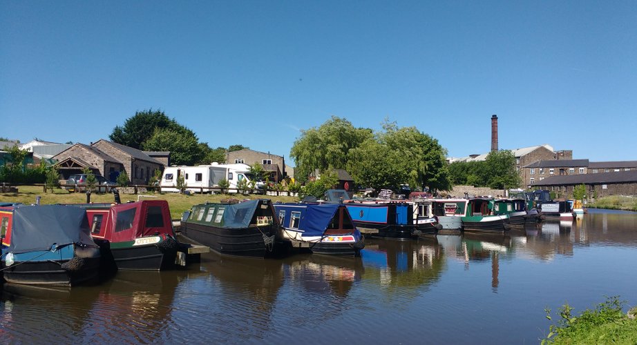
In both areas you will find evidence of past industrial activity to remind you that this was one of the original areas of the Industrial Revolution with its plentiful supply of water for propulsion and for industrial use. This is superbly illustrated by Cromford Mill, which was the first water powered cotton spinning factory developed by that pioneer of the Industrial Revolution, Richard Arkwright in 1771. Prior to that, spinning was a cottage industry practiced in the homes of the locals. The great news is that you can visit the factory and fully immerse yourself into the history of the Industrial Revolution, which changed the UK from a predominantly agrarian economy into an industrial superpower.
Further evidence of the area’s industrial past can be found in the canals and disused railways, many of which provide us with considerable cycling opportunities
Peak District -White Peak
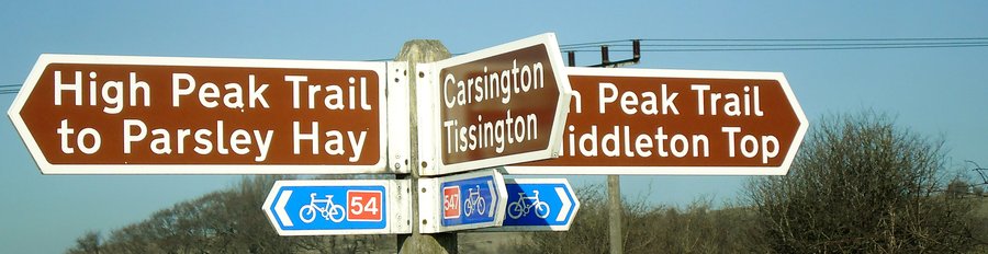
The White Peak area of the Peak District centred around Ashbourne and Bakewell is one of our favourite haunts, as it not only offers stunning scenery but excellent cycling centred on the Tissington & High Peak Trails.
The Tissington trail runs from Ashbourne in the south to Parsley Hay, a distance of 13 miles, where it joins the High Peak trail, which runs from High Peak Junction near Cromford to Dowlow near Buxton, where it sadly terminates and therefore does not allow for an easy ride into Buxton.
The Tissington Trail was formerly the track of the Ashbourne to Buxton line. It was finally fully opened on August 4th 1899 and survived until 1967.
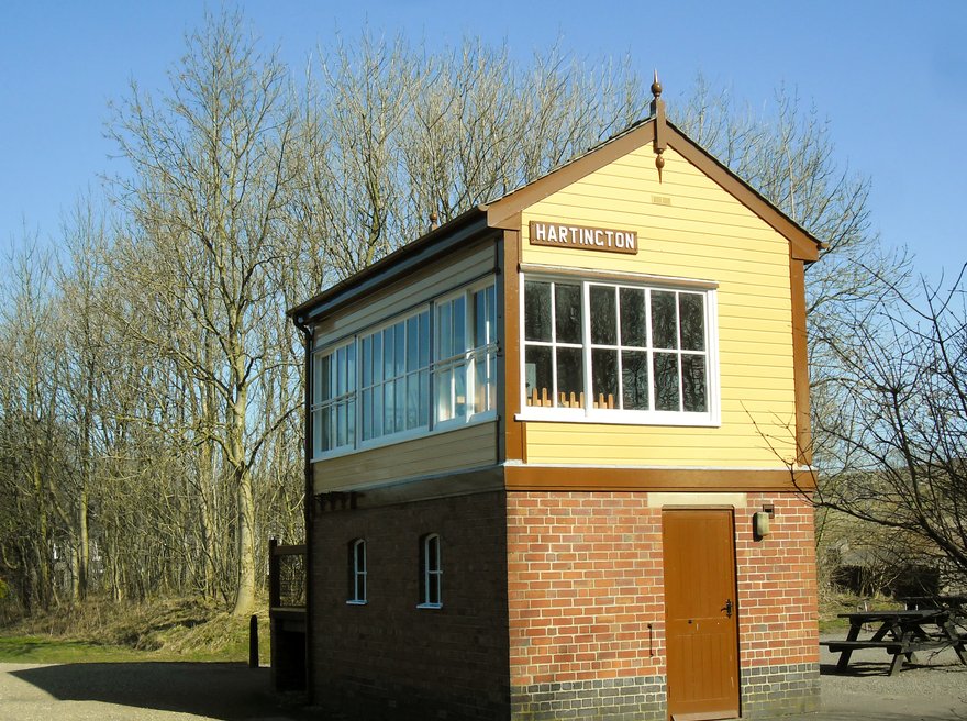
The signal box at Hartington, a few miles from the village which bears its name,between Ashbourne and Parsley Hay gives a potted history of the line
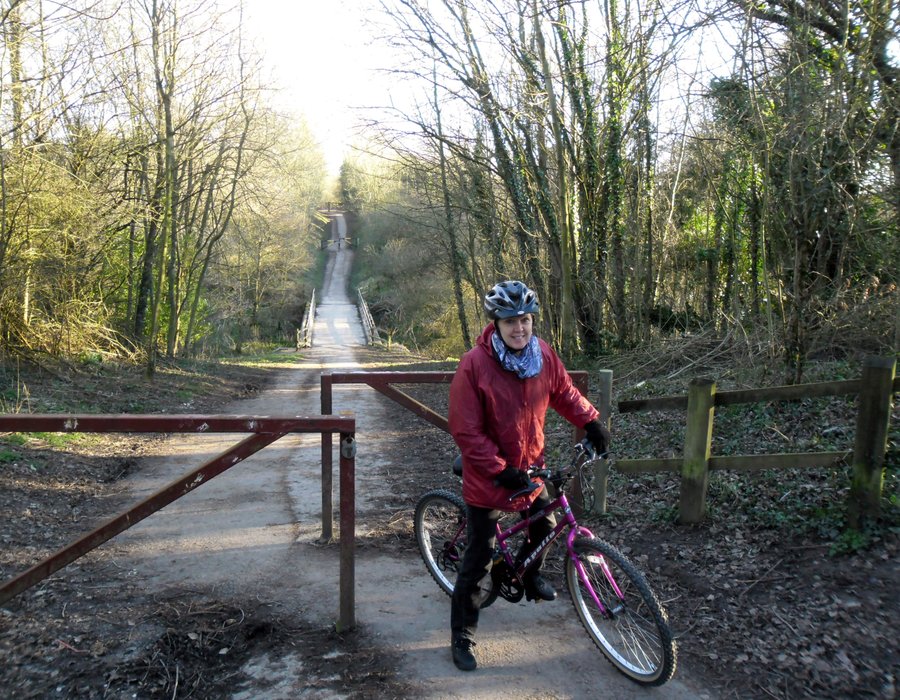
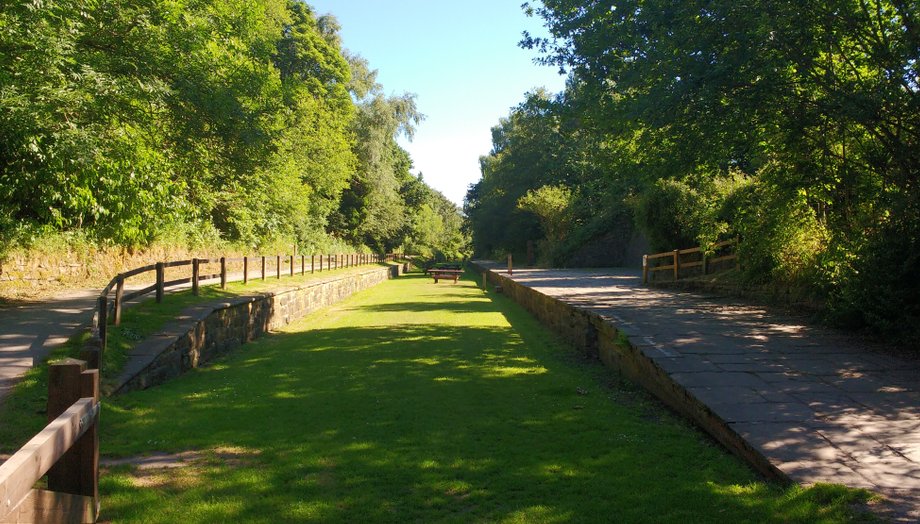
The loss of the railway line was, however, a gain for cyclists and pedestrians and in 1971 was opened as a greenway, being one of the first of its kind in the country. The surface has been greatly improved since its early days and is now a gravel track, which is easy for cycling and as with most railways without any significant inclines , the same can not be said, however, for the connecting High Peak Trail.
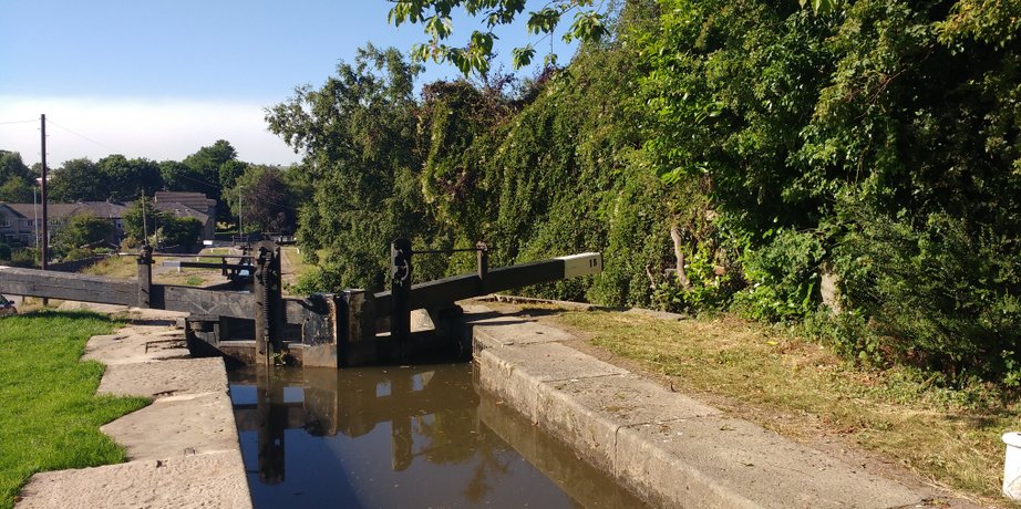
All 17 miles of the High Peak Trail follows the trackbed of one of the earliest railways in the country, the Cromford and High Peak Railway, which was completed in 1831 to carry minerals and goods between the Cromford Canal wharf at High Peak Junction and the Peak Forest Canal at Whaley Bridge.
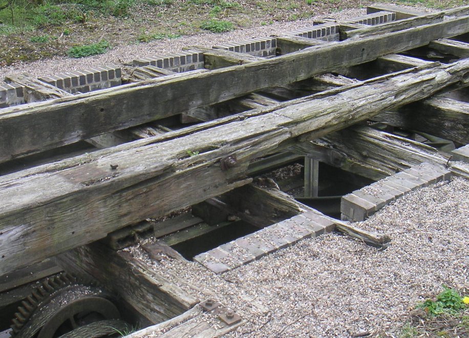
The original plan was to look at a canal to connect the two systems but this was logistically impossible on the basis of costs, so the railway was the solution. It is an interesting line because of the steep inclines, as you come into High Peak Junction and trust me they are steep and they necessitated the use of static steam engines to raise the carriages from the canal.
Remnants of the winding gear needed to pull the engines up
It is great fun to cycle down the inclines, though in these days of health and safety, there are the numerous signs advising cyclists to dismount, possibly as you may end up ploughing into pedestrians on the way down ,which certainly will not be a problem when you tackle the ascent. This one of the reasons we visit off peak; as the two trails and in fact the whole area can get very busy in July and August and Bank Holidays.
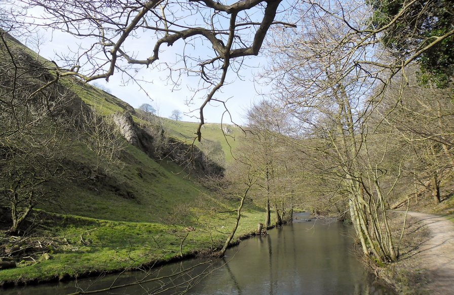
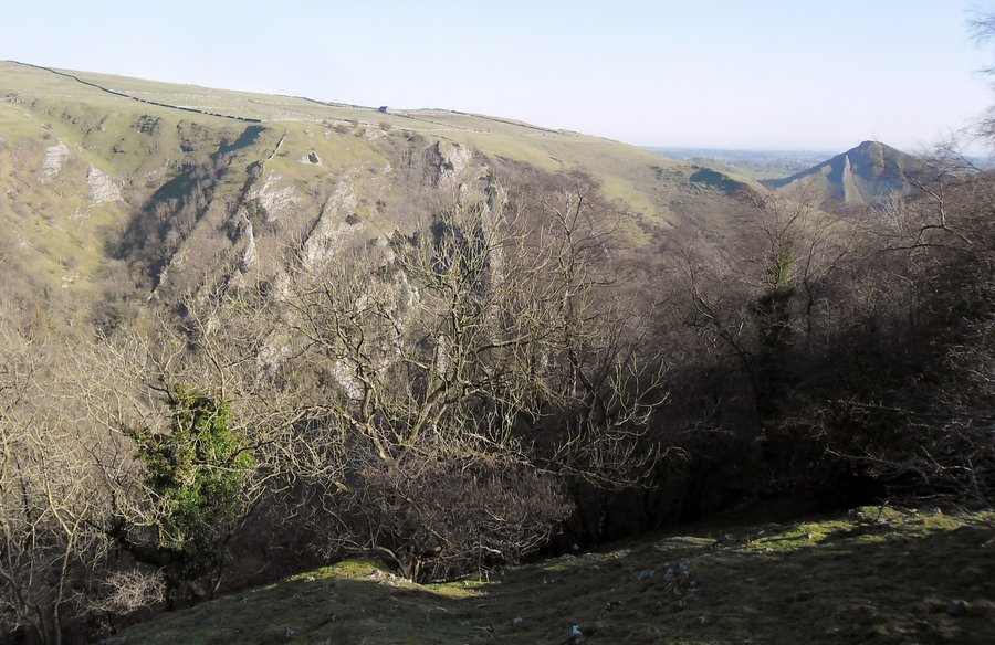
Dovedale, which is one of the main attractions in the area can resemble Piccadily Circus in the rush hour. OK I exaggerate but you get the idea.
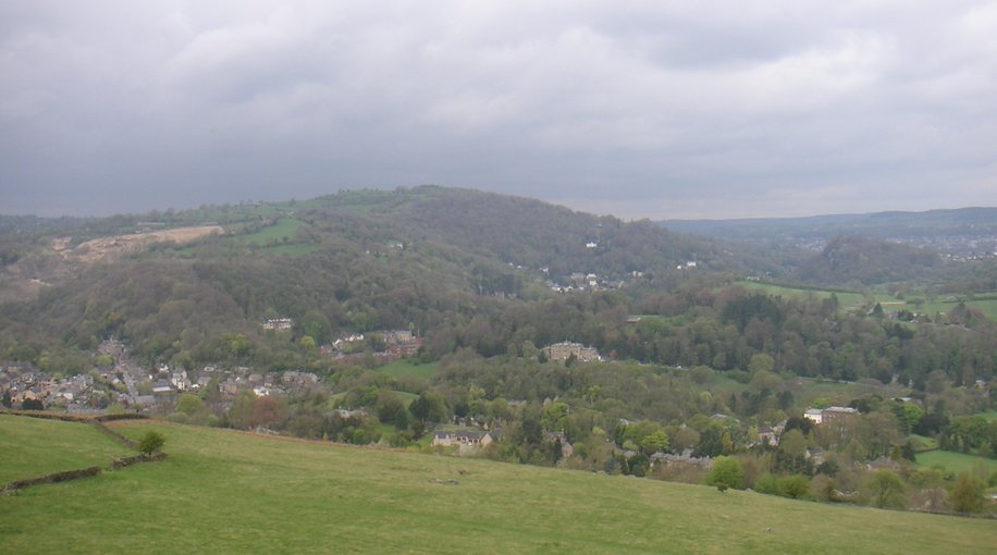
There is a brief respite in a level section between the two main inclines of Middleton and Sheep Pasture Incline where you can enjoy stunning views over Cromford.
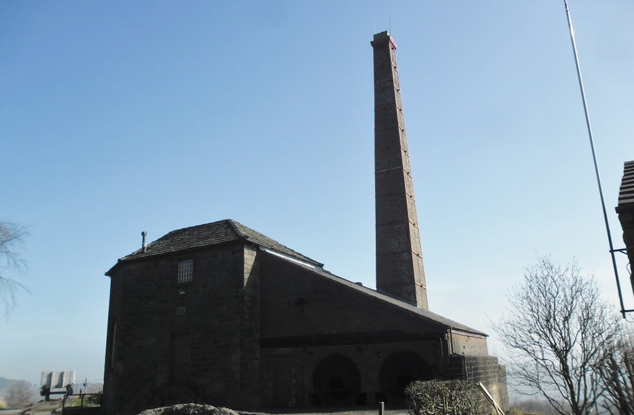
At Middleton Top there is a fine example of one of these engines and housing(pictured below) used for the purpose, which is still brought into action on certain days, There is also a visitors centre and refreshments available here, but only at weekends.
As with the Tissington Trail, the lines were victims of the Beeching Closures but I must confess I can not see how the High Peak trail ever made any money,
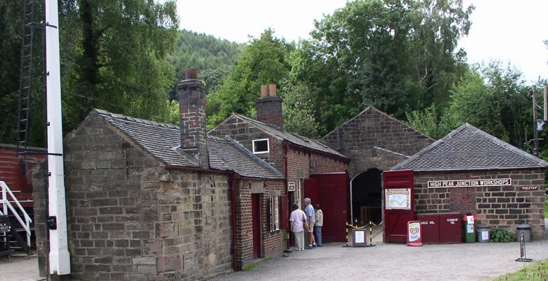
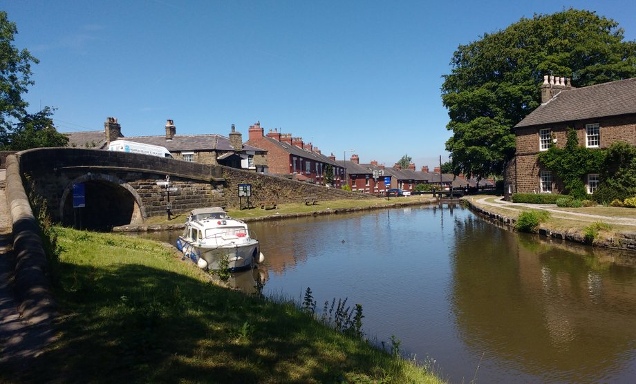
If you make it down to High Peak junction , though making it down is not a problem, as it is the return which is the challenge, you will meet the Cromford canal.
High Peak Junction - photograph courtesy of Steve Brown
As with the Tissington Trail, the lines were victims of the Beeching Closures but I must confess I can not see how the High Peak trail
A short ride along the canal brings you to Cromford Mill, which was the first water-powered cotton spinning mill developed by Richard Arkwright in 1771 and is a superb example of our industrial heritage and you can easily spend half a day exploring our industrial past.
If you want to explore the mills then you would be best advised to look at a campsite nearer. There is a camping and caravanning certified site at New Harboro and Griffe Walk Farm, which is near Middleton Top with direct access to the High Peak Trail.
The nearest commercial site is Birchwood Farm, which is a short walk from High Peak junction and there is a bridle path to the High Peak Trail.
We based ourselves at Rivendale Caravan Park, which is open for the majority of the year and is sited in an old quarry. It has good heated shower facilities and is ideal for off peak camping, particularly as it will accept Camping Cheques.
The added advantage of Rivendale is that Dovedale is readily accessible from the site.
You simply go up to the Tissington Trail, turn left along the trail and take the first footpath on your right and at the end of this path turn left into Biggin Dale,
When it meets the river Dove you have the choice of turning left towards Dovedale or right along Wolfscote Dale to Hartington.
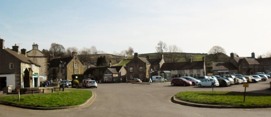
The walk along Wolfscote Dale is quieter and as equally beautiful as Dovedale and at the end it opens up as you enter Hartington. Offpeak, Hartington gives you the impression of one of those villages that time has forgotten with its duckpond and superb general store where they will make you a fresh sandwich, provide you with a hot drink which is best taken to the duckpond, where you can enjoy lunch overlooking the pond towards the garage, which looks like a relic from the 1930’s. It has a superb cheeseshop offering a staggering variety of cheeses .Alternatively there are a couple of pubs and other eateries.
You can easily cycle to Hartington though the descent along the minor road is steep but we prefer to walk along Wolfscote, which is an easy day walk, with lunch in the middle.
Dovedale is via MillDale with Polly’s for tea & snacks, though sadly it was closed when we visted.
At the other end at the National Trust carpark refreshments are also available but this was also closed as the carpark was being renovated, which was a blessing in disguise, as it limited the number of trippers.
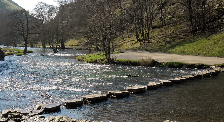
The Dale can get extremely busy but if you walk early morning or late evening, most day trippers have either gone or not arrived. If it gets too much you can always return by the high road by turning right past the Isaak Newton Hotel (also closed when we visited so good job we had our lunch) then climbing over Bunster Hill before dropping down very steeply at Ilam Rocks to join the Dale again. The descent was made more tricky by the fact, that though we had glorious weather, it had followed one of the wettest winters on record and the path was extremely greasy.
A different perspective, as you take the high road.
The Tissington Trail is situated opposite the site and it is about 7 miles from Ashbourne, downhill on the way down and a gentle climb on the way back. There are refreshments available at the cycle centre at the end of the line, though it is better to go into Ashbourne to the little café at the corner of the square. Ashbourne is a pleasant market town but is somewhat marred by the heavy traffic that flows through it and the number of large lorries.
The Tissington Trail towards Ashbourne is not all level but nowhere near the inclines of the High Peak Trail
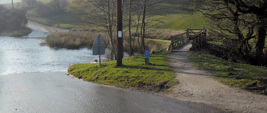
It is about 5 miles to Parsley Hay and the junction of the High Peak Trail. If you carry on for a short distance past the junction, there are refreshments available.
You then join the 15 mile section to High Peak Junction. The High Peak Trail is narrower in places than the Tissington Trail .
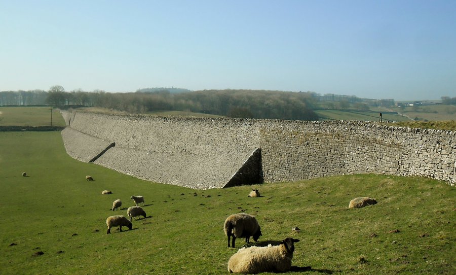
This embankment on the High Peak shows Victorian engineering at its finest.
You can return the same way or take two cycle ways back,the first via Carsington Water (refreshments available) and the second towards Biggin.Both are signposted from the High Peak Trail. They follow minor roads or by ways with busy junctions being by passed.
All the cycle rides are well signposted.
The Carsington Water route is the longest marginally but the more enjoyable, Both routes rejoin the Tissington Trail, the first at Tissington and the second just outside of Biggin.Both routes are predominately downhill with the only significant uphill section on the Carsington Water route, as you climb, after crossing the ford just outside of Bradbourne, before dropping down to the village of Tissington. Both routes are shorter than the return route using the High Peak Trail.
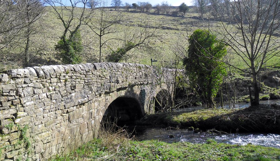
Ford at Brabington but you do not have to get your feet wet, which was a good job as the water levels were very high.
Alternative Campsites
Callow Top is a large commercial site with shop and bar etc and is located by road about ¾ mile form the Tissington Trail just outside of Ashbourne. We stayed here at Whitsun and though it was busy we were lucky to have a quiet pitch tucked into the corner though I had much sympathy frothe motor home pitched next to the children’s playground.
It is not a site that I would rush back to, and in any case it is not open when we want to visit the area, it is far too busy for our tastes though we had a pleasant stay here.
It did have the annoying habit of charging extra for showers. Imagine going to a hotel and being asked to put 50p in for a shower
Near Carsington there is an inexpensive site, Uppertown Farm Leisure but again not open when we wanted it.
Be warned,however,that if you want to cycle the High Peak Trail from here, it is a very steep climb. You would be better off cycling to Tissington and then doing it in reverse
The Motorhome and Caravan Club have a site at Carsington Water, which is a beautiful site and great location for the reservoir but it again is a steep climb to the Tissington.
he Dark Peak OS Map Explorer OL1
Two Camping and Caravan Club sites provide us with the cycling and walking opportunities in this area.
Hayfield
This is a superb site set in the Sett river valley, surrounded by hills and views of Kinder Scout.
A short walk along the river brings you to the very attractive village of Hayfield with its pubs, butcher and local stores and a short walk from the site is the Sportsman Inn, which does excellent food.
It is difficult now to envisage that this was once a thriving industrial area with several cotton mills, fabric printing and dyeing with calico printing particularly important. In fact the campsite is located on the site of the Kinder Printworks Mill and prior to that, during the 16th century, this area referred to as 'Cutler's Green was a major centre for the cutlery industry before Sheffield overtook it.
In 1868 the railway age arrived at Hayfield, connecting the village to Manchester. It is this railway, which closed in 1970 and now is the Sett Valley Trail which provides us with the artery to our cycle routes.
Sett ValleyTrail
You take the path from the campsite, the first short section of which you have to walk and then this opens up to the road, which takes you into the village. You go down to the church and then take the path, which crosses the by pass and leads you into a car park area, which is the site of the old station and the start of the trail.
The actual trail is quite short, about 2.5 miles but what it lacks in length it more than makes up for with some beautiful scenery. As you enter the town of New Mills, you cross one main road which is signposted the Pennine Bridal Way and then you meet another, which is adjacent to the River Goyt. You want to turn left in order to pick up the next stage of the cycle route, the Peak Forest Canal. Before you do, however, cross the road and continue to follow the Sett Valley Trail to reach Torr Top and the Millennium walkway. You will have to push your bike for part of this but it is worth it as it is spectacular, then retrace your steps, otherwise you will end up going through the town.
Peak Forest Canal
You have two ways of approaching this. Firstly you can cross the road and follow the Goyt Valley Way and this is to be recommended, as it is stunning and the first part is downhill. You then reach a farmhouse, where you turn right and then you take a path, where the last section involves quite a steep but short walk up to the canal.
The second choice is to turn right on the main road up to the Swizzles factory and before you cross the bridge over the canal, look for a road on your left which takes you to the canal. This is a more direct route but less scenic and the road can sometimes be busy and with heavy traffic.
Bugsworth Basin - turn left when you reach the canal towards the the terminus of the canal, Bugsworth Basin, which has been beautifully restored.
Marple approx 5 miles from New Mills
You start this section, effectively at New Mills Marina, on the other side of the canal, where there is in fact a certificated location of the Motorhome & Caravan Club
On our outward journey we went as far as the junction with the Macclesfield Canal, visiting the Marple locks on our return.
We turned off to go down the Macclesfield Canal to Poynton as were visiting relatives but whatever you do, you must go and visit the Marple locks, just above the junction and arguably some of the most picturesque locks you are likely to come across. Just above the locks is the Marple viaduct.
Past the viaduct the canal continues to Ashton, going through the Hyde tunnel just past the viaduct. I do not know if you can cycle over the tunnel as you obviously can not go through it, unless you are a canal barge.
The Macclesfield arm of the canal is perfectly cyclable but it is a bit more bumpy than the Peak Forest Canal.
We returned on the Middlewood Way, a cycle route from Macclesfield to Marple along an old railway and this is a much better cycle route than the canal.
The disadvantage of this route is that you have to go through the town from Marple station to pick up the Peak Forest Canal at Marple Locks, a busy route, not much fun but only a mile. You do, however, have the plus of seeing the Marple Locks, which must be some of the most picturesque in the country.
Lyme Pàrk
The NT property of Lyme Park is a doable 3 mile cycle from Disley, which in turn is about 2 miles from New Mills but be warned, this involves a steady climb, once you leave the canal.
Leave the canal at Hagg Bank Lane, go down Red lane, which leads into Green Lane, which then leads into the road up to the house.
The house and gardens are pretty impressive.
Kinder Scout
Any visit to Hayfield by any self respecting walker would be incomplete without a visit to Kinder Scout, irrespective of the fact that it is a stunning walk, particularly the section along the ridge following the Pennine Way. It would also be discourteous to the veterans of the mass trespass in the 1930’s that made access to these beautiful areas possible.
We made the walk in the opposite direction of that made by the pioneers of the 1930’s. The campsite is ideally placed for this walk. You turn right out of the campsite and right again along the road, passing Tunstead House on your left, before you reach a junction, where the road continues and the path is adjacent, to the left. You take this, which is effectively a stone trackway before you deviate to the left along the Pennine Way. This is the real fun part of the walk. It is basically plain sailing until you get to the Kinder Downfall, where you have to deviate left, though it is obvious, as you have to follow the ridge. In the background were the fires of Saddleworth Moor, which were tinder dry but mercifully they did not spoil our walk or views.
All the time you can see the Kinder Reservoir, which is your ultimate destination. You descend steeply and take the path to your left at a T junction of paths. This is where my map reading failed me as we took the first left, which took us down right by the river edge of William Clough. This, however, was the summer of 2018, it was very hot and very dry, making this path passable. The main path runs higher up the valley. Following William Clough, which was not the easiest of walks, you reach Kinder Reservoir and then follow round, back to the site.


Crowden
Though not such a spectacular setting as Hayfield this is still a very attractive site and though full, it did not seem over busy. Moreover they were fairly relaxed that I had arrived half an hour early, as it is only half an hour from Hayfield. Bear in mind that this site is somewhat isolated, the nearest pub is the Bulls Head in Tintwistle, about 3 miles away.
The main purpose of visiting this site was to do the cycle ride along the Longendale Valley, following a disused section of the Manchester Sheffield railway. The only difficulty is that to access the trail you need to avoid the A628, which is incredibly busy and has a lot of heavy traffic.
Fortunately you can gain access by turning left out of the site, taking the farm road, climbing before descending to the A628. Cross the road with care and you are now on the Pennine Way. You will have to walk your bike down a short section before picking up a track through a pine forest, this is a bridleway and easily cyclable. At the end you have to walk your bike again down a short section before you pick up the road, which crosses the dam and leads you to the cycle track, part of the Trans Pennine Way.
In one direction you reach the Woodhead tunnels, the first tunnel was once the longest railway tunnel and the first Trans Pennine tunnel. Subsequently two other tunnels were constructed and now the Victorian tunnels have been sealed and the third tunnel is used to carry power cables.
In the other directIon you reach Hadfield, which proved useful in picking up a bottle of Malbec to go with the excellent steak, that we had picked up from the butcher in Hayfield.
Both rides are easily doable in half a day.


Walks
Tintwistle about 6 miles in total linear
This is the walk you need to take to get to the pub
You take the same route as for picking up the cycle ride but instead of crossing the dam, you turn right and follow the valley, counting the dams, as you want to start climbing up to the village, after the third dam.
The plan was to find a tea shop and we thought we had achieved it when we came across Pixie Bakes but sadly for us they were not opening until the next day. The day, however, was not lost as we found the excellent Bulls Head Inn, a real characterful pub.
Circular Two Dams Walk About 3 miles
Go out of the site, the way you came in, cross the road and take the path that veers to the left and follow this until you reach the dam, cross the dam and pick up the cycle way and turn right. Continue along the railway track until you reach the next dam, cross this and pick up the Pennine Way, cross the road and return to the site following the farm track.
PS We did this walk to see if there was an alternative access for the bikes, to pick up the cycle way but unfortunately when you reach the dam there are some very steep steps.
Black Hill Linear or Circular approx 8.5 miles
This is a stunning walk, the first part is a steady climb, before a steep climb to Laddow Rocks, then following a ridge with spectacular views, before reaching open moorland and the steady climb to Black Hill.
You take the farm track at the back of the campsite and turn right at the signpost for the Pennine Way and follow this all the way to Black Hill. The path is well defined and over the moorland there are stones set in to follow, so even though this route can get very boggy, you will stay dry on the stones.
When you reach the trig point at Black Hill you are faced with a choice. You can either return the same way that you came, which is no hardship or you can take the path to the right, following the spur and cross Tooleyshaw Moor. Head towards the double summit of White Low before veering to the right and cross Hey Moss. There are a number of paths, which take you down to the disused quarry and the steep descent back down to the campsite.
Be aware, however, that the second route's path across the moor is not so well defined so if your map reading skills are not good then return by the way you came. It also can be very boggy, not a problem for us in the roasting summer of 2018.


