Motorhometrips
with tips for cycling & hiking
Marriotts Way – a cycling tour with our motorhome based at the Caravan Club Certificated Location at Attlebridge.
Marriotts way is a 26 mile off-road cycle way linking Aylsham with Norwich and the plan was to take one day to ride into Norwich and the other day in the other direction to Aylsham and Attlebridge fitted the bill nicely, as it was roughly equidistant between the two.
Marriotts Way primarily consists of two sections, the first from Norwich to Whitwell and Reepham, which was part of the Midland and Great Northern Railway, which in turn was an amalgamation of a number of smaller companies. The second section from Wroxham to Reepham was part of the Great Eastern Railway. In the 1960’s the two railways were connected by the Themelthorpe loop, which effectively connected the two stations in Reepham and could be classified as the third section of the Marriotts way but more about that later.
The nickname for the M & GN is the ‘Muddling and Go Nowhere Railway’ which if you look at the extensive 19th century map of old railway routes which crisscross Norfolk is perhaps understandable but a little harsh. Railways in the 19th century had to be built with a private act of parliament and with private money and as with all civil engineering works could prove to be expensive and there was no grand plan of a coordinated railway network. In reality you had competing railway companies vying for similar routes and this competition was often extremely fierce. The main railway building period, ‘ railway mania’ was in the 1830’s and 1840’s and as with all speculative booms a lot of money was to be made on the key routes but as with all booms and coupled with a bit of fraud , money was also to be lost. Our two railways were built in the later stage of the 19th century, past the railway building heydays and it does not take too much imagination, that outside of Norwich, we were not talking about major population centres; hence profitability was always going to be a challenge. There was a boost to the routes with the advent of the seaside holiday and the East Coast resorts attracted visitors from the Midlands using the railway. The First World War brought another shot in the arm with their use for troop movements. As for our station at Attlebridge, its swansong was perhaps with the establishment of the nearby air force base in the Second World War, now apparently a turkey farm.
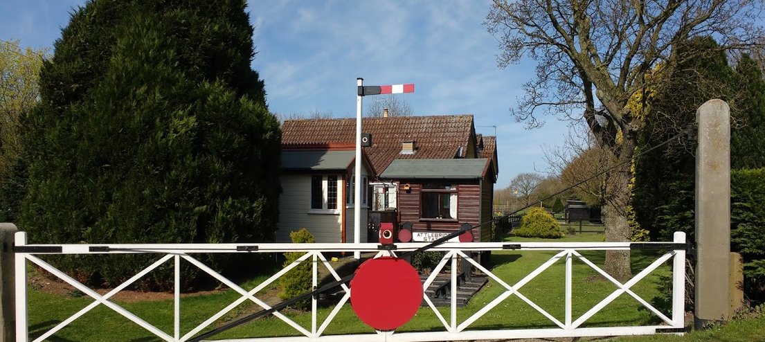
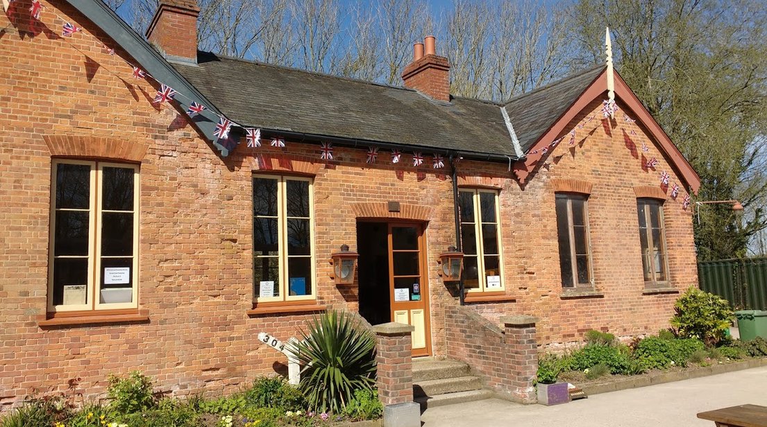
Attlebridge Station
You could, however, imagine the excitement of the arrival of the railways in the 19th century, which offered the ease of transport into Norwich and then onto London, when road transport was still slow and difficult. The increased use of motor transport, however, after the Second World War was the writing on the wall for these marginal rail routes and for those that did not close, Beeching did the rest. What, however, was the loss for the railways were a gain as Marriotts Way is an excellent greenway and superb wildlife corridor
The route takes its name from William Marriott, chief engineer and manager of the M & GN for 41 years.
Attlebridge Station is now the home of Janet and Keith, and though it is not as such a restored railway station there is nevertheless sympathetic reference to its past. The site is a grassy attractive rural open site and other than being ideal for the Marriotts Way it is perfect for visiting Norwich and exploring North East Norfolk. You would not find a nicer couple than them on this planet, they have a great sense of humour, a good yarn to tell and they are extremely helpful. On our first day we wanted to get the bus into Norwich and Janet kindly drove us into Drayton, as the bus service, number 28, here is much more regular than the X29 service, which runs from Attlebridge (on the main road ,by the bridge over the river Wensum). She even offered to pick us up again from Drayton, when we returned but we managed to get the X29.
Our first day was more eventful than normal, as though the pitches appeared firm, when I attempted to use the levellers, traction was lost and we promptly became stuck. Keith gave me full marks for not attempting to rev up and try and get out and thus ending up deeper in the mire and I think secretly he was pleased, as it gave him a chance to use his pride and joy to tow us out, a 1960 McCormick B275 tractor in pristine condition. The front wheel drive on the motorhome just does not give any traction on damp grass and I have to come up with a better preventative solution. This has to be a plus as well for this CL, an insurance policy, in the event of bad weather. For the rest of the stay we used the hardstanding to the entrance of the site, which proved to be ideal. The irony was it was not wet and the ground seemed fairly firm, it was just bad luck.
Update March 2024 - Keith sadly is now in a nursing home, a man who enjoyed an outdoor life and was always active.
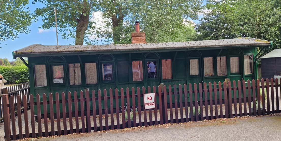
I do have an affinity for this area, as my mother was born in Yaxham and I can trace my family back for several generations in Norfolk; additionally after my mother married her first husband, Arthur Hilling, in the late 1930’s, they set up home in a converted railway carriage in Taverham, with my brother Barrie being born before the war and my other brother Chris after the war. In the interim Arthur had been a prisoner of war at the hands of the Japanese.
After relating this story to Janet and Keith, they told me about such a converted railway carriage outside of Attlebridge and Janet kindly leant me an autobiographical book written by Katherine Yorke, setting out her childhood days growing up in Attlebridge in the railway carriage in the 1920’s. Could it have been the same one?
The book sets out the realities of living in one of these converted carriages, the absence of running water, a privy which was effectively a hole in the ground and the severe cold and damp in winter, exacerbated by the use of paraffin heaters which left the walls running with water. The latter I can recall in our council house in the 50’s and 60’s when the outside walls use to run with so much water in winter, it seemed like Niagara. You have to have considerable admiration for my mother, bringing up two young children in these very basic conditions. What was also interesting in the book was her mildly eccentric father who tried a variety of jobs, often not lasting very long, including running a market stall and even trying to get a job as a lecturer at Oxford University, hardly surprisingly a role which he was not successful in attaining.
The Strange Family at Yorke’s Hill by Kathleen Yorke
I subsequently discovered that parts of the parkland attached to Costessy Hall, which had been acquired by the military during the First World War, had been made available for the working class at £5 a plot. On these plots shacks were assembled together with the use of converted railway carriages, later to be replaced by more substantial accommodation, with a street pattern developing, this ‘shanty’ town became the forerunner of New Costessy. So the area has a reputation for the use of converted railway carriages. Was one of these moved to Taverham or did they live in New Costessy?
Holt railway station has a restored residential railway carriage
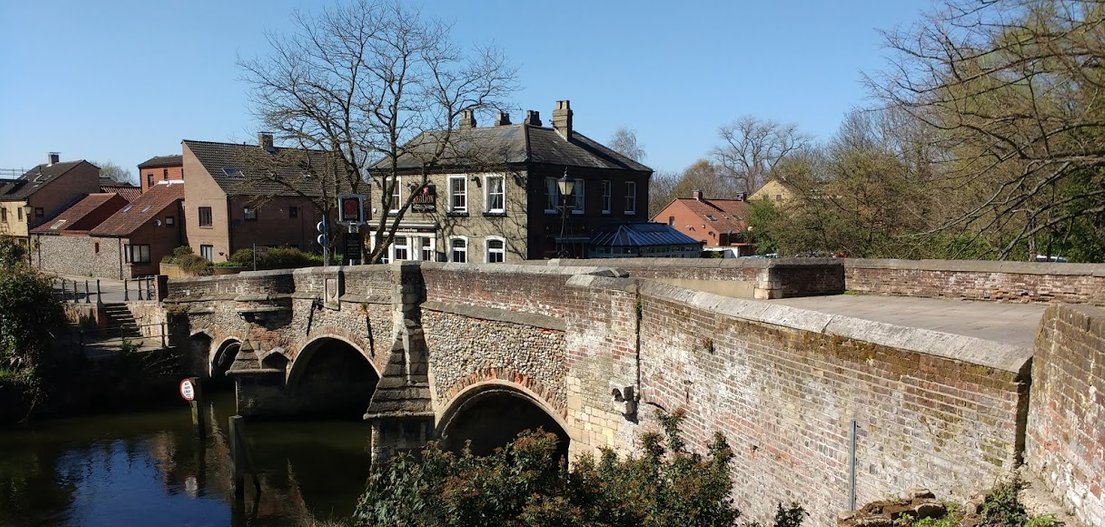
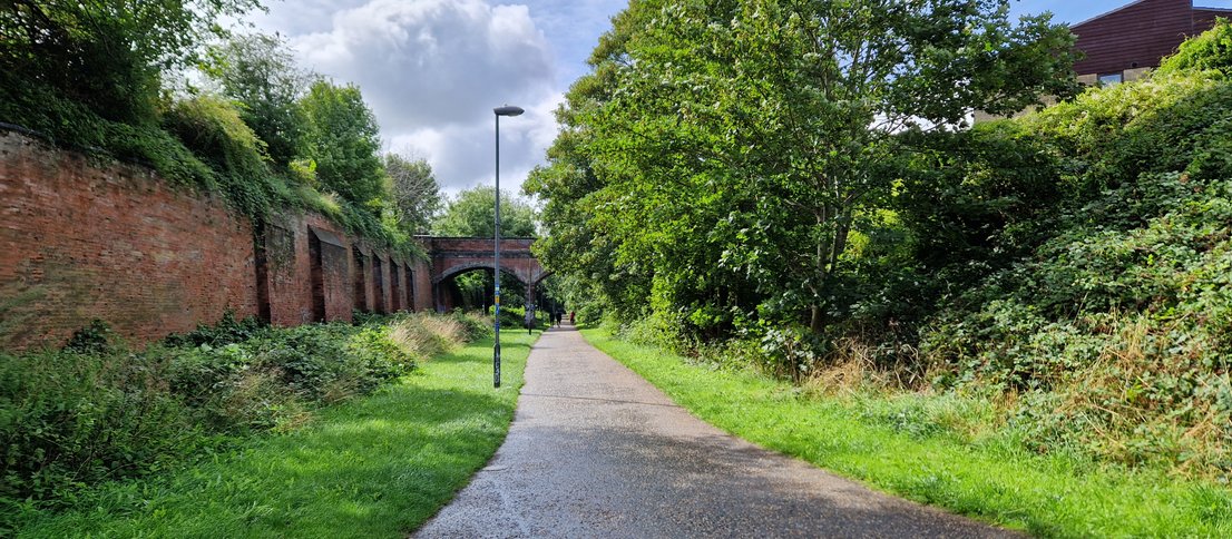
Attlebridge to Norwich with a tour of the City, officially 8 miles to the City but I reckon it’s nearer 10 and the total tour clocked up 27 miles.
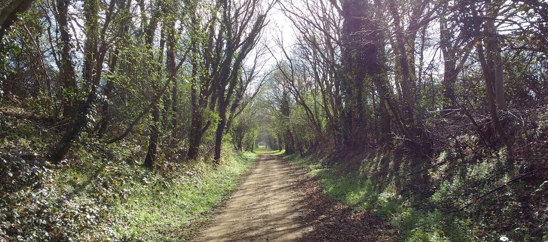
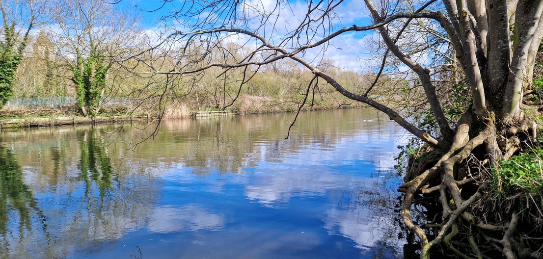
As you would expect from a railway path, the cycling is pretty easy and the path surface is good, for its first part tended be compacted earth and it is not until you reach the outskirts of Norwich that it becomes paved. The route is never too far away from the River Wensum.
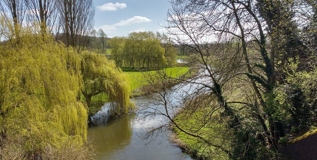
The River Wensum from Marriott's Way
The majority is off road with a short stretch on road deviation, at what used to be Drayton station but now an industrial site. I wonder if my Mum caught the train from Drayton into Norwich on VE day with my brother Barrie. I know she attended the celebrations as I can pick her out in a photograph on that day.
Nothing remains of Norwich City Station, which was severely damaged in the war and never rebuilt, which surely indicated the writing on the wall for this line. When you cross the inner ring road you can follow the Wensum into town. Norwich is a bike friendly city, which is not surprising as it actually lays claim to being the first city in the country to fully pedestrianize a road - London Street in 1967 and surprise surprise the town has continued to flourish, perhaps Regent Street & Oxford Street in London could take a leaf out of Norwich’s book. It has recently extended this pedestrianisation so a large part of the city is off limits to cars, which makes it a great place to explore with the bike, albeit you will have to push it in the busy pedestrian areas.
The Market Place which has been a focus of trade and commerce since the Norman’s established their market below the castle, after the conquest, is dominated by the City Hall and Norwich’s magnificent library and to the right the early 15th century medieval Guildhall, the finest example of such a building outside of London. It is also the site of Café Brittania, a café run by prisoners from Norwich prison who together with ex offenders get valuable experience, as well as providing a superb service and follows the successful café in Norwich prison.
From the market go through the stunning late 19th century Royal Arcade and up to the imposing Norman Castle and though there has been a castle on this site since the Norman Conquest, the present Norman keep dates back to the late 11th century, fitting in status for the then second largest city outside of London. Norwich retained its status as a major city throughout mediaeval times, with its wealth built on wool, with only London and Bristol being larger and a position it retained until the Industrial Revolution.
Follow Castle Street towards your left and down Prince of Wales Street, downhill all the way to the river and turn right and follow the river path with the imposing Thorpe Railway Station, terminus of the Great Eastern on your right. Apparently Norwich City Station was as imposing, which may not be too surprising as Victorian railway companies vied with each other to build the most imposing stations to reflect their status; if you are in any doubt just look at St Pancras Station, terminus of the Midland Railway in London. You continue to follow the river to Carrow Road, the other citadel in the city, home of Norwich City Football Club. On the other side of the river you can see some of the older industrial developments which once dominated this area.
We then continued to take the Yarmouth Road out of Norwich to Thorpe St Andrew, which is about 2 miles and though this is a busy road with heavy traffic, we cycled on the pavements. I do not see a great problem with this, outside of towns, as long as you ride slowly, aware of any possible pedestrians and dismount when you come across them. I see this as a sensible use of the space and infinitely safer than the A1242. Lunch was taken at the riverside pub ‘The Rushcutters Arms’ on the River Yare with a big plus being that we were able to eat outside overlooking the river Yare.
Return the same way, passing the imposing Victorian church of St Andrew on your right, with the remains of the medieval church, destroyed by fire, in the foreground. I don’t think I have mentioned that Norwich has more churches than any place in the UK or in northern Europe and it seems that there is a church on every corner, many of which have been converted to alternative uses now. The excellent Buck Inn, a beautiful building is just in front of the church, which is a bit more individual than the Rushcutters; the latter which is part of a chain but nevertheless lunch was fine.
When you reach Carrow Road, follow the river again to Prince of Wales Road, cross and take the river path on your right as this avoids negotiating the pub and the steps on the left side of the river. Continue along the river until you cross the river at Bishopsgate.
A slight detour to the right takes you to Cow Tower, part of the medieval defences of the city but not part of the original city walls. A short detour to your left takes you to Pulls Ferry, an iconic building in Norwich and where they brought in the stone from Caen Normandy to build the beautiful imposing Norman cathedral.
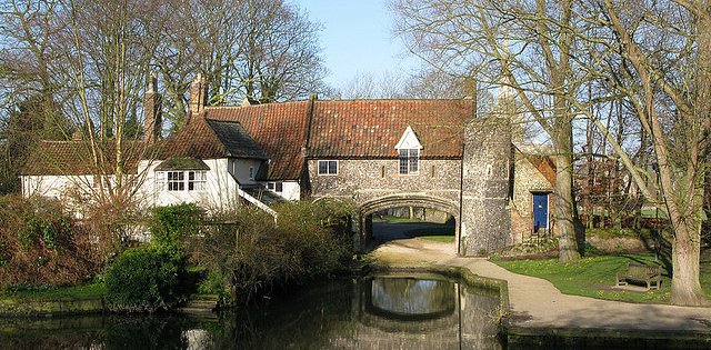
Pulls Ferry
It is from this part of the river that you get some of the most impressive views of Norwich Cathedral.
Continue along Bishopsgate to the Great Hospital, a medieval hospital, still in use today. To see a history of the hospital, with video guides and pictures, use the link below:
Continue along Bishopsgate to my favourite pub, the Adam & Eve. It is claimed to be the oldest pub in the city dating back to 1241, with a brewhouse owned by the Benedictine monks at the nearby Great Hospital to satiate the thirst of the workmen from the cathedral. The pub today is a 17th-century building constructed from brick and flint with the Dutch gables added later. There is a Saxon well beneath the lower bar floor.
Cut through to the cathedral for coffee at the excellent refectory.
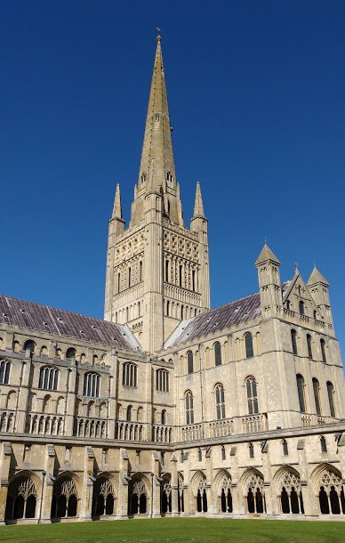
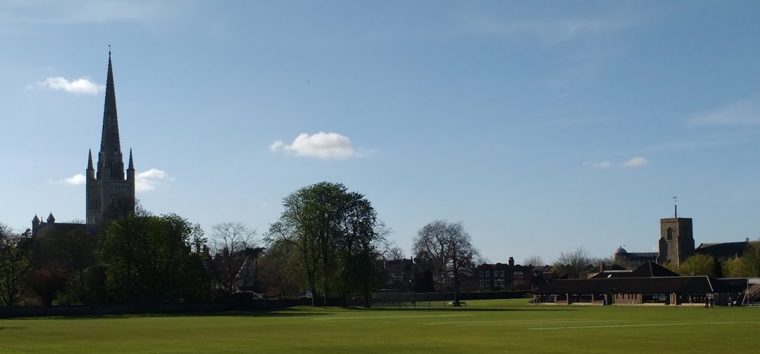
I love Norwich Cathedral; it is a superb example of Norman architecture, with simple but at the same time imposing and grand lines, less fussy than Gothic architecture. The beauty of the building is that large parts of it are still classically Norman and the Caen limestone facing is awesome. The cloisters are the second largest in the country, second only to Salisbury and it offers fantastic views of the spire. The Cathedral Close and the surrounding area down to the river is a haven of tranquillity not even really disturbed by the games field of the Norwich School.
A plus at this time of the year were the resident peregrine falcons and though the eggs had not hatched, I had magnificent views of the male flying over the cathedral.
As you leave the main entrance of the Cathedral Close you enter my favourite area in Norwich, Tombland, which for me is the very heart of Norwich. The name Tombland originates from two old English words, which mean open space and it became the Anglo Saxon market place and the palace of the Earl of East Anglia, before the market was moved to its present site in Norman times and the Normans began their cathedral building programme .
Turn right before riding up Elm Hill on you left or more likely walk up the cobbled streets of this picturesque street with many fine Tudor buildings. The elm trees, from which the street got its name, have all gone, as a result of Dutch elm disease.
The street follows the river Wensum, as in the past wealthy merchants had their houses facing the street and their factories and workshops behind, with the workers houses between them and the river and hard to believe now, an area of considerable squalor.
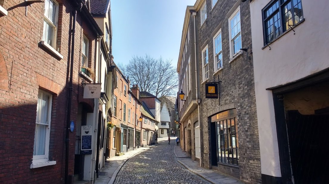
Elm Hill
Cut down to the river and follow it back to the start of Marriotts Way.
Attlebridge to Aylsham including Blickling Hall 30 miles round trip
The track surface on this section of the route was marginally better than the section to Norwich with one notable exception, where the track bypasses Cawston station, where it is narrow, runs alongside a field and was fairly muddy. Additionally this route has a more rural feel to it, as you are away from the outskirts of Norwich and this is particularly so for the Reepham to Aylsham section. For the first part of the ride you are again not too far from the Wensum, with the added plus that you are in Otter habitat and though I have seen them during the day, they are predominantly nocturnal, no such luck this time. Otters were virtually extinct by the 1970’s, either hunted out of existence or poisoned by the use of pesticides but they have now made a good recovery, though anglers are apparently not happy.
You pass the site of the old concrete works at Lenwade which represented the last use of the line in transporting these products, as late as 1985 and you will see the remnants of the old gravel pits, now lakes, turned over for angling, naturalists and birdwatching. Lenwade station still exists and is now converted to a private home.
The next stop on the line is the Reepham & Whitwell station, which is home to the Whitwell & Reepham Railway Preservation Society, which in a relatively short space of time has accumulated an impressive array of steam engines and other railway memorabilia. This proved to be a welcome refreshment stop. The café and station buildings are tastefully presented adorned with a considerable range of railway memorabilia and you have to say the restoration is impressive. The Society runs steaming days along a small section of track alongside the main ‘track’ which is now the Marriotts Way. What was slightly concerning, when talking to one of the guys at the railway, was the suggestion that they wanted to join their track onto the main ‘track’. I am all in favour of railway preservation societies but this railway was never a commercial success and in reality can never be again. The last think that we want to see is railway track on this superb greenway again. It is a fantastic wildlife and ecological corridor and I do not want to cycle along a railway track.
http://whitwellstation.com/
Reepham and Whitwell Station
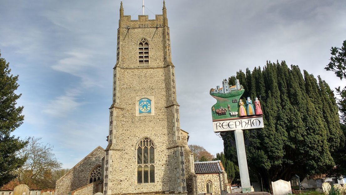
You are faced with a choice now, take the Themelthorpe loop to Reepham station, a 5 mile trip or take the road and follow cycle route 1 for just over a mile and pick up the Marriotts Way section to Aylsham on the other side of Reepham. Looking up the track it did not look muddy at all but we chose to take the shortcut and cycle into Reepham. Reepham is a small market town with an attractive market square with its charter going back to the thirteenth century. It is unusual in that it had three churches on the one site, where the manors of Reepham, Hackford and Whitwell met, though today only two of the churches survive, St Mary and St Michael. The third church, All Saints was destroyed in a fire 1543.
You follow the signs for cycle route 1 out of Reepham and on your left is the station of Reepham, which now serves refreshments and is the other end of the Themelthorpe loop.
You continue a hundred metres past this and on your right is the entrance to the Marriotts Way to Aylsham. This is the most rural section of the track. When you arrive at Cawston, you have to divert around the old station and this was muddy and though there is a CL here, access to the track is not as good as at Attlebridge and it is much further up the track. It may be useful for tackling the Bure Valley Railway track at Aylsham.
At the end of Marriotts Way you are faced with the Bure Valley Railway opposite you but if you turn left and follow the road then this takes you into the town of Aylsham, another market town and similar to Reepham, again dominated by its church, St Michael and All Angels but in this case only one.
We had lunch in Biddys Tearooms, sitting outside in the garden, which was very pleasant. You cannot beat the archetypal English tea room and this is a fine example in a wonderful country town setting, off the market square with the church adjacent.The only comment I would make is that it is probably more geared to afternoon teas than lunches. I ordered lunch and then needed to order a cake as the lunch was quite small but that was hardly a hardship, as the cakes were delicious.
On entering town we saw the National Trust signs to Blickling Hall and a quick check on Googlemaps indicated that it was less than a couple of miles. As I had forgotten to bring my NT cards with me, I made a quick phone call to check that they could access my records and after receiving an affirmative answer, off we went. The ride was not a difficult one and the roads were not that busy but I would take issue with Google who said that it was mainly flat. To the left of the road for a fair section of it there appeared to be a pathway but we did not use it.
As we entered the village we were confronted by this amazing Jacobean house on our right and even better there was no long ride up the drive to it.
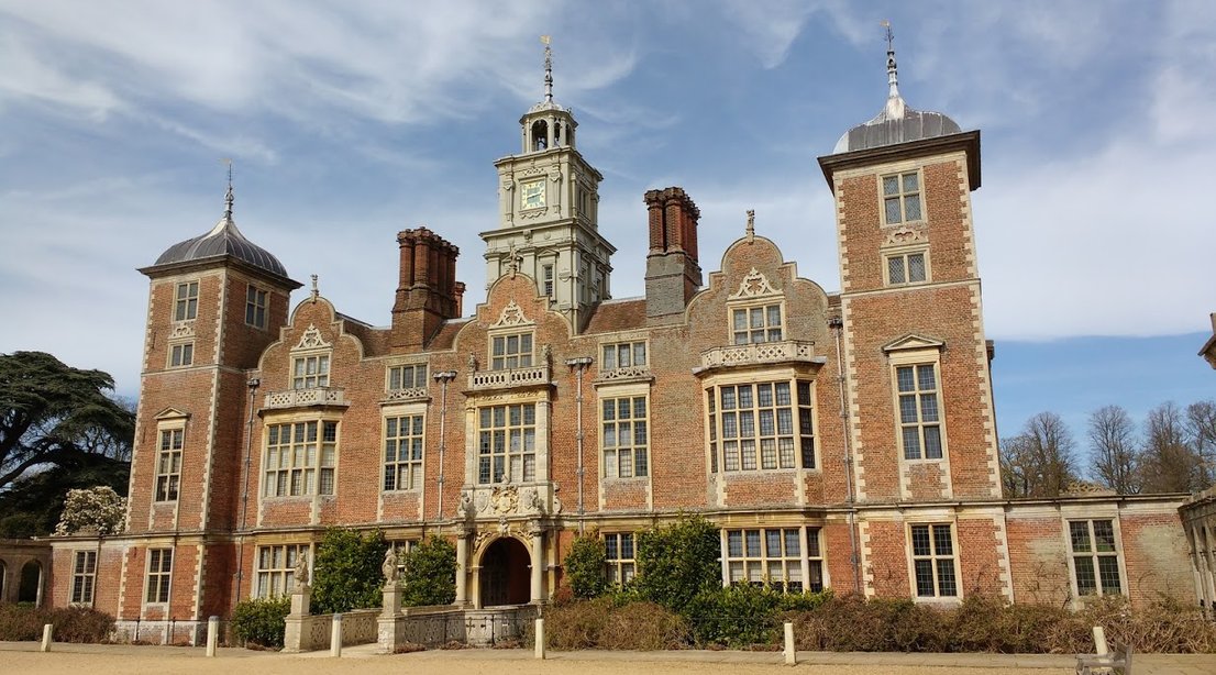
The opening overview on the National Trust site says that one day is never enough and that is true, as we spent the afternoon in the House and only had a brief look at the gardens and did not even touch the parklands.
The plan on the way back was to take cycle route 33 on the road virtually opposite and go to Silvergate and then pick up Marriotts Way further up the track but we ended back to the main road at Aylsham, which we crossed, headed up to the church and market square and then returned on the way we came in to Aylsham to pick up Marriotts Way. This route back to Aylsham from Blickling was in fact a better choice; the road was quieter and flatter.
Camping & Caravan Club SIte Martineau Lane Norwich
An alternative base for the Marriots Way, with the added advantage that you are in walking distance of Norwich, is the Martineau Lane site, which is situated about 30 minutes walk from the City centre. You can either take the Lakenham Way which is an old rail route to Norwich Victoria station, which used to be the terminus of the Great Eastern Railway, whose task is now fulfilled by Thorpe Station. Alternatively you can turn right out of the campsite, instead of left and head down to County Hall and Carrow Road before picking up the river walk. Nothing remains of Norwich Victoria Station though there are a few old railway bridges over the cycle/footpath.
The campsite is a pretty site with all grass pitches, close to the River Yare. The facilities, however, are somewhat dated and there is no motorhome service pitch but as a base for exploring Norwich it is second to none.
An alternative to picking up the Marriotts Way at the Barn Roundabout is to take this route, which is on the Kamoot App. This route basically goes east and then up to the north of the town to Horsham St Faith, before cutting down to pick up the Marriots Way at Drayton and then following it back into Norwich.
The road does involve some traffic, before you pick up the quieter routes as you turn off Plumstead Road onto Green Lane North. The cycle route is then a mixture of quiet roads and dedicated cycle routes. You can not fault the cycle ways that follow the A1270 north of Norwich, commonly known as the Broadland Northway but somehow this did not extend to providing a safe method of crossing it. The scariest crossing was from Salhouse Road at New Rackheath, where you are trying to cross a three lane carriageway, followed by another two lanes of fast moving traffic. Patience here is certainly a virtue as lack of it could have serious repercussions. What is even more bizarre is that they are undertaking major development in Rackheath so if they want to encourage cycling, particularly by youngsters then this issue has to be addressed before someone is taken out.
We did, however, once we were out of Norwich enjoy a very pleasant ride with lunch at the Red Lion Drayton, before following the more genteel Marriotts Way back into Norwich.
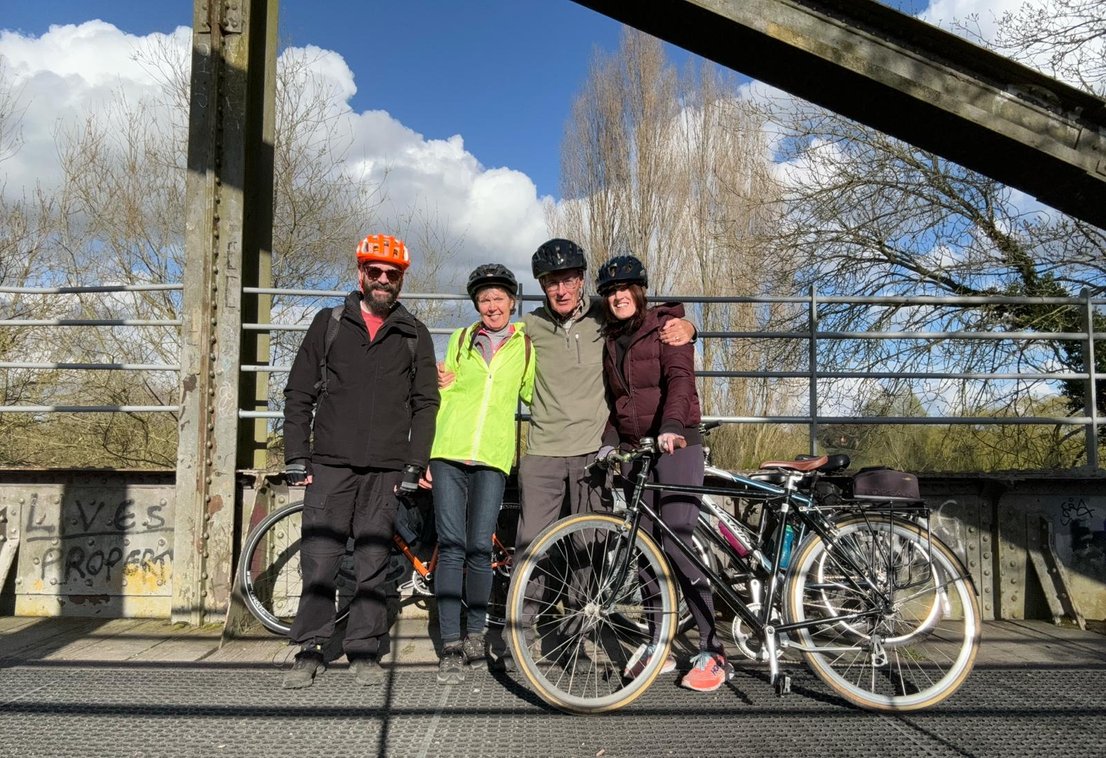
Suitably refreshed after visiting the Red Lion, posing for team photo on the iron bridge over the Wensum. It was also excellent timing for our gentle poodle back to Norwich as this section of the Marriotts Way was closed in February 2024 for resurfacing works and an excellent job they have done as well. The total ride from the campsite was 29 miles.
Whitlingham Country Park
We have been to Norwich countless times and somehow we have not been to this country park, which is an unforgiveable glaring omission as it is only half an hour walk from the campsite. You simply walk down to County Hall and take the first right after the BP garage .It is a haven for birdlife and is a very pleasant walk along the River Yare and the two broads and there is the added bonus of an excellent café in the car park.
On the way back we walked into the village of Trowse, which is a fairly typical Norfolk village with the added benefit of a pub and first class vegetarian restaurant but check the website before you go as it is only open at certain times. It also doubles up as a cookery school and it has the added benefit that it is easily walkable from the site.
It is always difficult to recommend restaurants in Norwich but the beauty of the City is that you are spoilt for choice. There is additionally countless cafes and pubs to choose from. Norwich has a vibrant centre with countless independent stores alongside the chain stores.
At the mid range we like the Turkish restaurant, the Gem on the river near the station. It is always buzzing with excellent service and good food at reasonable prices,. Another favourite is the Cosy Club situated in the old National Westminster Bank on Bank Plain. Even if you do not eat here go in for a coffee or a drink just to admire the interior of the building, you will not be disappointed.
As a Norwich City fan it is an essential requirement to recommend Delia's restaurant at Carrow Road. This is at the more expensive end of the range but the food is excellent, served in a very traditional manner, think starched tablecloths and napkins with very attentive service.
Bishop's in St Andrews Hill is a another good choice at the higher price range.
One cafe that we loved was Bread Source in Bridewell Alley, which was an ideal coffee and cake stop after visiting the Norwich Museum opposite, which is well worth a visit.